Southern England Orienteering Urban League
Bridport Urban Event
Saturday 14 July 2018
Many thanks to all who helped at Bridport Urban. It was a smooth, trouble free operation thanks to the hard work & experience of our team of willing volunteers. There were many generous compliments paid to the quality of John & Di's courses which had survived a catalogue of calamities - if ever an event had a difficult birth, this was it! Only the previous weekend, just before final maps were printed, there was a major fire in an old industrial complex crucial to 5 out of 6 courses! It seems that disaster management is an essential skill for orienteering officials...
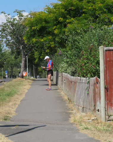
Bridport is an old market town with a history of rope and netmaking - the hangman's noose was nicknamed the 'Bridport dagger'! Parts old & new have intricate patterns of little paths and alleys providing complex route choices. It was decided to use 1:5000 scale for courses 1-3 which covered a wider area and 1:4000 for courses 4-6. The improved legibility of the larger scale was striking. A good idea, though there's obviously a balance between extra clarity and what can sensibly fit on an A3 sheet.
It was disappointing that entries were much lower than other SEOUL events, for people missed a treat. Despite poor support, it was hugely appreciated by those who came and a credit to all concerned.
Mike Kite
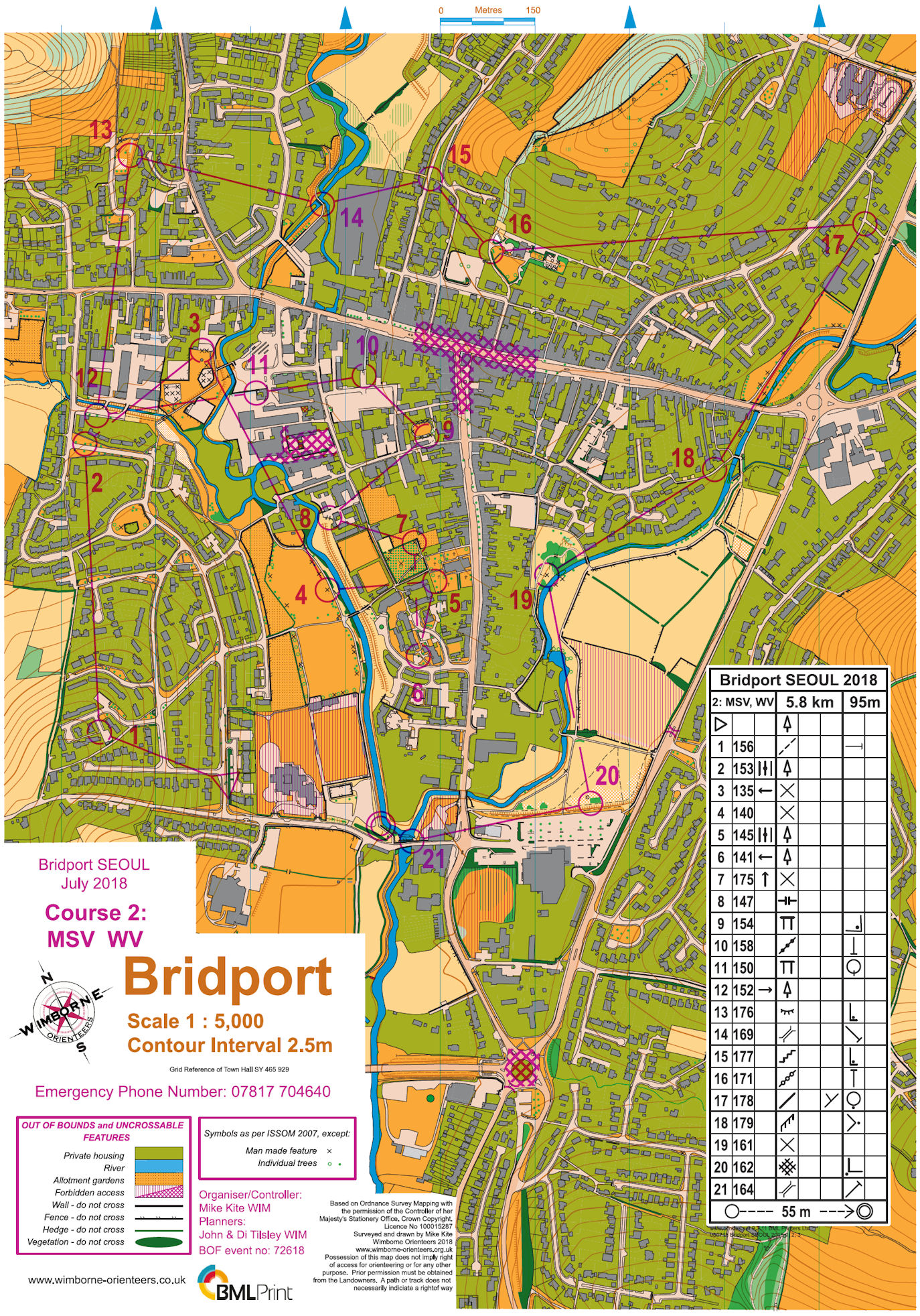

Courses 2 (MSV, WV) and 3 (MUV, WSV)
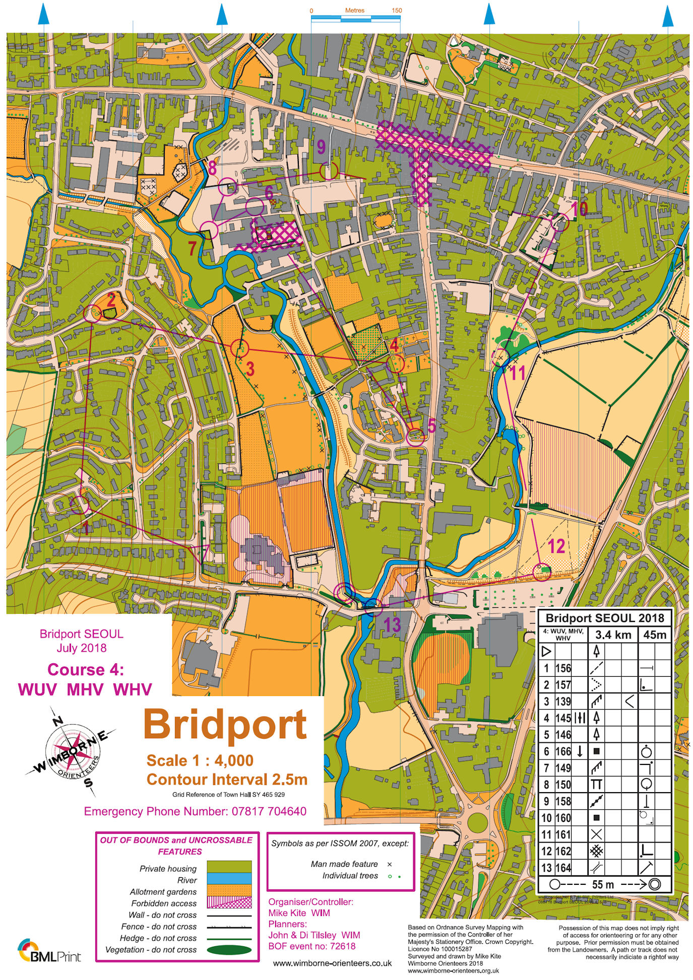
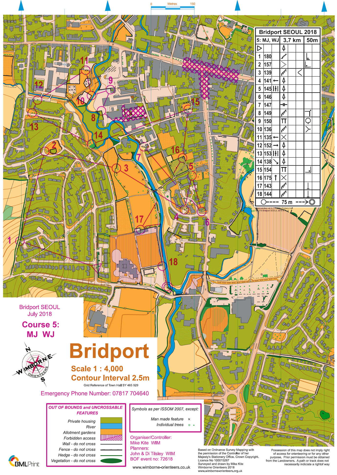
Courses 4 (WUV, MHV, WHV) and 5 (MJ, WJ)
Planners' Comments
When I agreed to plan this event in Bridport way back in autumn 2017, I had no idea what an epic it would become. At times it was if the Gods didn’t want the event to take place. Mike, in his introduction, explained some problems we had to overcome, but also the added “bonus” of some serious medical issues within the organising & planning teams.... After the fire a week before the event, we had to make the decision, based on the available information. The decision was to remove 2 controls and mark a crucial section of the map out of bounds, just as the printer’s deadline loomed. In reality when the smoke and dust settled we could have left things as they were (with only 1 way through OOB) but it was better to be safe than sorry.
Planning on Mike’s excellent map for a Saturday afternoon event in the height of the holiday season is a real challenge! The exceptionally busy street market in the centre of the town had to be out of bounds - the volume of foot and road transport was just too great. Throw in the busy summer A35 and a Music Festival and you have some idea of what is involved. I was pleased to hear from many of the competitors that they enjoyed the courses that I set, but they hadn’t realised Bridport was so hilly! It is not Rome, but does have four steep hills!! The lack of route choice in the North East portion of the map meant that Course 1 were spared Coneygar Hill, so they only visited three of the hills. I rather liked the fact that when they reached control 22 they could look down and see all the high spots they had visited, but I guess the more competitive amongst them didn’t have the time!
My one regret is that I set what I thought was a really challenging Course 5 for the older junior competitors. It was a true urban orienteering course with multiple route choices that had no compromises revolving around safety, as there were several areas of very low volume traffic roads. The number of rivers and their limited crossing points were ideal. Not a single competitor ran course 5; course 6 was almost as bad with only 3 entrants - very disappointing. Choosing a different time or day to run the event would mean that the out of bounds area in the centre of the town could be removed. This would really open up planning options allowing a lot more North-South route choices - some of the best alleyways weren’t available for this event. Next time, eh?!
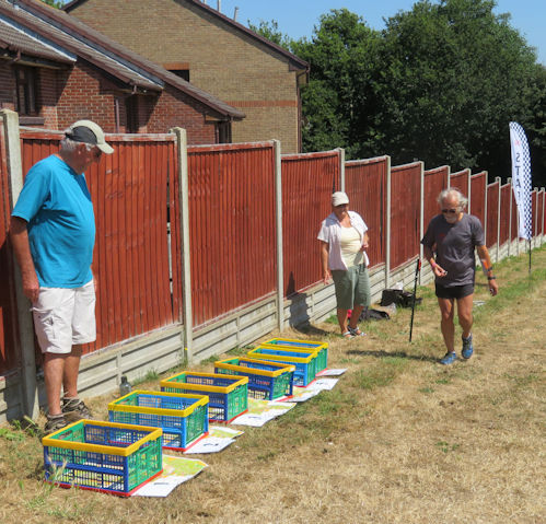
Delighted to say no vandalism/theft of controls (& Di spent a happy time near the skate park watching the scooters/skateboards, along with the peculiar navigation decisions some people made there.....).
We were really grateful to Steve, Lizzie & Tamsin, David & Judith and Mary of WIM who helped us to put out/collect the controls - it would have been a mammoth (nay, impossible!) task without them. Also very grateful thanks to Chris & Lynn Branford (who weren’t able to be at the event) who went round two of the courses, in the planning stage, to check we had distances/times correct, plus some very useful advice on several occasions! Mike’s “controlling & organising” hand was, as ever, meticulous, but light. Thanks, Mike (& Mary!)
John Tilsley (Main planner with the initial inspiration for the courses & cyclist extraordinaire visiting all control sites on bike to tag, re-tag & photograph on several occasions, as well as putting out & taking in controls by bike!)
Di Tilsley (Assistant planner: first checker & “tweaker” of courses; OCAD & Condes operator; putter out & collector in of controls, allegedly by car, but still managed to walk over 13km during the day!).
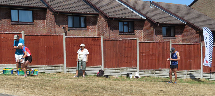
David, Judith & Kath ran the Start
Background photo of West Street from the town hall clock tower. Colmer's Hill, loved by artists, is left of centre in the distance.