Summer Adventure - 2021
by Kevin Pickering
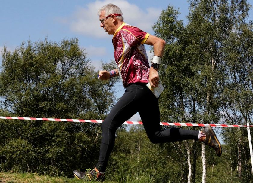
My summer adventure started with the British MTBO cycling event based in Forres, Scotland.
The 4-event weekend started with a middle-distance event in Grantown on Spey in a Friday night drizzle.
There were 41 competitors in my A class including the very fast M21 age class, best to avoid them when they were cycling near you! As this was the first event for most of us for 2 years, with a few competitors who had never done MTBO before, it took some time to get used to reading the map under pressure. I was good up to control 11 after which little mistakes crept in leading to big mistakes.It was only in the car park afterwards when someone asked how did I do the control near the fence that I realised that I hadn’t seen a fence and had gone straight to the finish which was close to control 16 and didn’t go to the last 2 controls near fences, DSQ !! Still, it was good fun, the rain held off and there were only a few late evening biting critters.
Saturday morning - Sprint course, Sanquhar woodlands, 1:5000 map, adouble-sided mapand6.6 km to ride.
Again, I was fine up until control 10 when I turned the wrong way down a small path and then couldn’t work out what I done and had to hunt around until I could work out where I was on the map. I took 8minutes 21 seconds on this leg with the fastest time being 57 seconds and then another mistake on the penultimate control gave me a position of 35 out of 52. My final time of 56mins.56sec with the fastest M60 in 41.01gave some great riding down mountain bike tracks made in the woods. I would definitely go back to the area again even without any competition.
Saturday afternoon - Middle distance, Altyre, optimum route 16.3km
Some very technical riding along very small paths with many tree routes to navigate over and past, luckily it was dry.It was a warm up for Sunday’slong-distance event. Midway in the pack today 25 out of 47
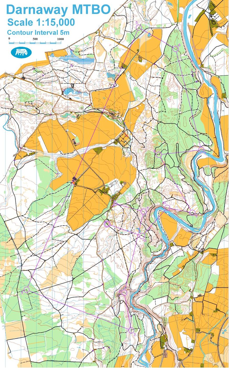
Sunday morning – Long distance Darnaway Forest, event 17.4 km course optimum route 27.1 km
First control was 60maway but up a short 30m climb which was either a push or carry bike up and then I thought the best route was straight back down a steep hill where even with both brakes fully applied the wheels were still slipping down, a little bit scary to start with. The 500 metres took me 6 mins. 10sec. Control 2 was tricky map reading as you had to go a long way past the control to get back to it as you are only allowed on roads, tracks and paths in MTBO. No. 3 was down horrible rutted, overgrown and wood strewn minor paths, very difficult to ride. No 4 was good riding once you got up the hill away from control 3 but getting to No. 4 Ihad to open the map to find where control 5 was as with the map folded I could not see it.It was over 6 km straight line route away, with many different route choices, but it was flat and fast. Even with re-folding the map a couple of times and eating on the way I covered it in 19min.04sec. Control 6-7 I missed the route by the river which was faster than my route by road and track as the track was quite sandy and slow. Going down a minor path to control 8 I had a tumble off the bike and took a few seconds to recover and decided to keep going down track as I didn’t want to come back past where I had crashed. Control 10 the planner had warned us in pre-info to take care as it was on a minor path with a view of the river, 60m straight down with very little to stop you before the river. The track was about 9 inches wide with some small tree stumps on the opposite side of the river where you had to be very careful your pedals didn’t hit and throw you off.Thankfully everybody made it safely but it did scare me a little bit.I finished in 117mins.18secs, position 10/21 and 2nd out of the 5 M65 competitors today.
A great weekend with some very fast and some very technical riding with hills which we don’t have here in the south, although it’s a good thing we don’t have the midges as well!
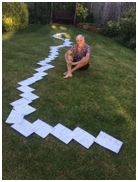
One of the longest straight line legs seen in UK 4-5 which route would you take ?
Adventures Continue
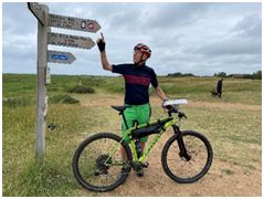
As a warm down (!) I had worked out a route to cycle from Holme, Norfolk to Lyme Regis, Dorset, around 600k mainly on bridleways along Britain’s oldest roads, PeddarsWay, Icknield Way and The Greater Ridgeway taking 8days with one rest day in the middle. Hilary, my support crew for the trip, and myself arrived in Norfolk on Wednesday and as it was a reasonable evening decided to knock off the first 10km until our hotel for that evening as it was directly on the route. That was a good decision as breakfast was very filling and it took me a good time to warm up! The beauty of the PeddarsWay is that it is very straight with only a few sections where you are not allowed to cycle and very little height to climb. I passed only 3 people walking the route and one cyclist out for the day but I did see hundreds of pigs. I should have been more concerned here with some of the state of the bridleways as several I was supposed to take had disappeared either under farmers ploughs or overgrown with stinging nettles and brambles causing me to change route. I was pleased to reach our B &B near Thetford after 87 Km.
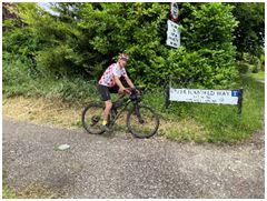
Next day was nice fine weather which was good as it was going to be a long one.It didn’t start very well as the tracks were tough being large flints and sandy soil but lovely country around Newmarket with some beautiful racing stables. After going over the M11 the bridleway disappeared into a wheat field where you could see the end of the path joining a road in about 800m, with the faintest of paths where someone had walked.The only alternative route was to retrace my steps, a diversion of about 7km, so I pushed my bike through but had to stop every 10m to unwrap the stalks which had wrapped themselves around my wheels and gears. It took me about 25mins for 800m.After that I had to clamber over fences and pick my way through stinging nettle patches on what was supposed to be a new cycle route and cycle 500m on the dangerous A505 before Hilary found me near Royston. 106 Km in 8hours 48.
Day 3 started with a nice ride through Letchworth but I lost the route north of Dunstable where a new town was being built and bridleways had been closed or rerouted but found my way through with a good climb up to Dunstable Downs and onwards to near Ivinghoe Beacon.
It rained overnight so day4 cycling was slow with very sticky muddy paths as many riders use the tracks around here.It also kept raining on and off all day but I managed to dodge most of the showers as I was in the woods. I was also very pleased to find a very small farm café just for walkers and riders near Wendover. I ended today by the Thames at Goring.
I had a rest day on the Monday and managed to repair and clean and oil my bike.
Day 5 - Goring to Avebury, 68 km on tracks, 2km on roads. This was fine when the wheels were rolling but today with the wet and 35 mile an hour gusts into my face it was hard work. I even had to pedal when going down hills! Just before Avebury I found myself over the top of my handlebars with blood on my thigh, a bruise on my hip, rolling in the long grass. I had gone down a large pothole disguised with long grass. 20m around the corner the council had put a sign out ‘Beware track under repair’! Today was also the busiest on the trip with many cyclists riding The King Alfred’s route but most going with the wind at theirbacks.
Day 6 Avebury to Hindon.Just hard work again today around SalisburyPlain with the wind still blowing hard against me.
Day 7 I got in trouble after the first 5km where the bridleway had again disappeared and got myself stung and scratched going down the route it should take. So, I then stuck to the minor roads and climbed up to Win Green which was a real slog but what a ride after that down to Tollard Royal. About 3km downhill on a fast track but again tracks had not been cleared. I had to carry my bike through a farmer’s field which made me end up in Ashmore so I then had to cycle up Washer’sPit hill and finally arrived in Shillingstone for a well-earned late lunch. As I was so tired and battered by then Idecided to mainly stick to roads to get to our hotel in Cerne Abbas with the last bit on tracks. However I got stuck again as track disappeared through fields of barley. Today was the most climb at 913 mts in 68 km.
Final day to Lyme Regis.Apart from a couple of tracks I knew I was going to stick to roads today as my legs were still tingling from the many stinging nettles but it meant going into Charmouth and then having to take the main road to Lyme. That’s a big hill after all the past days but what a freewheel down into LymeRegis where we celebrated with beer, ice cream and a swim.
Total ride 613 km, 5498m climb, 60hours including stops. An average of 10km hour due to the rough and tough off road cycling.
Why do it? because it’s there and parts of it are brilliant and it was a real sense of achievement.
Thank you, Hilary, for looking after me.
Scottish 6 Days
We entered the Scottish 6 days in January and had managed to book the last available caravan on what was supposed to be the official site.With Jo, Annie and 8 month old Lyrawith us it would be a new experience of early mornings and split starts but great to see Lyra at her first Scottish and our 10th event. Wimborne were given the 1st 2nd and 5th days to run as the event was cut down to comply with Covid regulations restricting runners to 1000 a day.
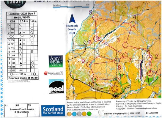
So, first day’s event on a lovely hillside at Ardchattan. It must be one of the best drives to an O event that we have taken with good weather and views of the starts. 50m uphill from the car park for the older classes. My course on M65S was 3.5km with 145m climb and my main worry before the starts was that I had not had enough recent Orienteering events to practice all the technical details,bearings, pacing and most important for me slowing down at times to check the map.Also using all the features that Scottish orienteering has that we don’t have in the South West, rocks, cliffs, distinctive hills, contours, marshes and so many more re-entrants.
On my first control I was a little off the correct route and took 30 seconds longer than I should of and later I also thought it wasn’t a very good control as later starters could see the general area where the control was from above the start lanes. No 2, I was the quickest up the hill. No 3 I didn’t take the best route and got a little stuck on a cliff and then ran too low for my control, 1 min error. No 4 should have been easy but I relaxed too much and went up the wrong hill and then ran to the wrong boulder 1min 40sec.error. 5 was OK with slight hesitation. No 6 you could see the wood as you ran from 5 and I was sure it was correct and ran down the re-entrant but no control appeared so panicked and went away from the area to relocate. I came back along a minor ditch to find the control was about 10m from where I was originally but the other side of the ferns so I couldn’t see it. I was also the 1st starter on my course so there were no routes trampled in the ferns yet.2 min. errorso Ithen raced to no 7 and made another bad error.Even though I was convinced I was correct I got to within the control circle but could not see the small crag in the ferns so when I went a little past it I saw a control post in a definite re-entrant and ran to it, checked the number. Not mine but Icouldn’t see where this re-entrant was. I decided to run towards no 8 and come back at the control again and this time found it hidden in the ferns 3 mins. error. Later on, from other maps, I found 3 controls in re-entrants within 100 mts of each other and the control I had found was within the circle of my re-entrant. I’m not sure why they couldn’t have used the crag or made one off a spur. So, a little bit upset I ran hard for the next 5 controls which were straight forward 2nd,1st,1st,1st,1stand ended up 5th out of 17. 4mins.19secs. down on the winner but upset with myself as I could have won. On to tomorrow. It will be better!
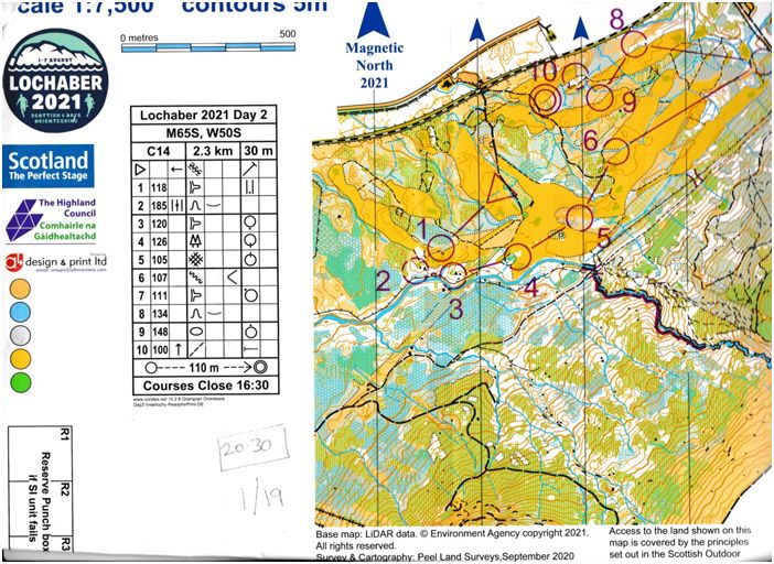
Inverlochy
A later start which was unfortunate as it was only 10mins down the road from us. 2.3km and 30m climb,I thought it must be tough as so short. We made our way to an area overlooking the finish where everybody was walking around barefooted on the golf fairway and sitting in groups cheering on the finishers. The sun was shining, people were happy and saying this is the orienteering we all love, except for one or two of the longer course competitors coming back saying the forest was very hard and unforgiving. So, when I picked up my map and looked at the route for no. 1 either up a hill, through ferns, cross a stream over a marsh and hope to hit a spur or go round the fairways.A longer route but much safer to start with. I chose the fairways and as this worked well adopted this strategy for the rest of the course. Only one 20second error on the whole course, I won 6 out of the 10 legs and won my class in 20mins.30 seconds with 2nd coming in over 2mins.30secs later than me and I had walked some of the course. I was especially pleased with my run in as I knew I was doing well so pushed extra hard and ran the 110m from last control in 25 seconds. Thanks in part to SIAC 10 seconds faster than Jo and Annie.There’s life in the old man yet!A long way to go for a 20min run around a golf course, not a usual Scottish 6 day event unless you had controls in the rough or up the hill and then it was a very different story.
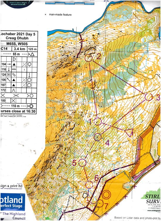
Day 5 Creag Dhub
Today I had 3.4km and 125m climb. They were the same courses that were run on day 4 with the only difference being that today it was raining, not cold but just wet with ferns that went above your head. I don’t always do well in the wet as when I wear a hat to keep rain off my glasses I don’t take in all the things around me and tend to run with my head down.If you do stop running your glasses steam up and stop you seeing anyway. Still there ought to be some paths made by competitors yesterday if they are going in right direction. The first control was straight up the hill 75m climb. I picked a good route with use of a trampled path and ticked off all the features I passed so I walked virtually straight to the control in the fastest split. No. 2, another 30m climb 600m across the slopes. I used cliffs, marshes and isolated white areas to go to the control with the 2nd fastest split. No 3 was all the way down the hill. l made an error but re-located on the only path on the map and found the control but knowing I had made a mistake I ran a lot harder up the hill towards no 4 along a well trampled path. I lost my brain(!) and stopped thinking. I put all my efforts into running which I was enjoying.When I stopped to check the map fitted and there was my control, no 107, on a boulder. I checked the number on my control descriptions, yes it was there. I punched the control and ran on towards my next control. Everything was fitting with the map until I hit a fence, but looking at the map I couldn’t see a fence anywhere in the areabut it wasn’t a new fence so it must be marked. I unfolded my map and found a fence just over the fold line but I shouldn’t be here!What have I done? I calmed down and looked again and noticed I had punched control 5 before going to no. 4. OK easy solution, back to 5 as its on way to 4. On the way running hard across ferns, mud and rocks I fell heavily and just saved my face crashing into the rock with my hands but knocked my upper leg muscle hard (which still hurts 2 weeks later) After getting my breath back my leg had seized up and was painful with every stride, which threw my concentration right off and I just wandered around without thinking. When I was finally nearly ready to give up, I remembered something I had told someone earlier in the week that I had run in Scottish6-day events 55 times and only been DSQ once, so I wanted to finish. So I stopped and worked out where I could be and hobbled to thecontrol just behind a boulder. I had been here before about 30mins ago when I had passed on the other side which was confirmed later on my route gadget.
I finished very slowly but still was 6/15 on the day and would have been 6/11 on day 4.
So, of the 57 events I have taken part in in Scotland my courses have been 301 km in length with 9780m climb but I think you can double that for the routes I have taken!
Roll on 2023 Moray where I go up a class and hope I have more orienteering events to practise on prior to the 6 days !