
...or should that be topography, or topology, or morphology... and does it really matter...
I've been mapping the Golden Cap estate in West Dorset with the blessing of the National Trust. Contours are complex and abundant so I used LiDAR (Light Direction and Ranging) contour data for the first time. It was an eye-opening encounter - I was stunned.
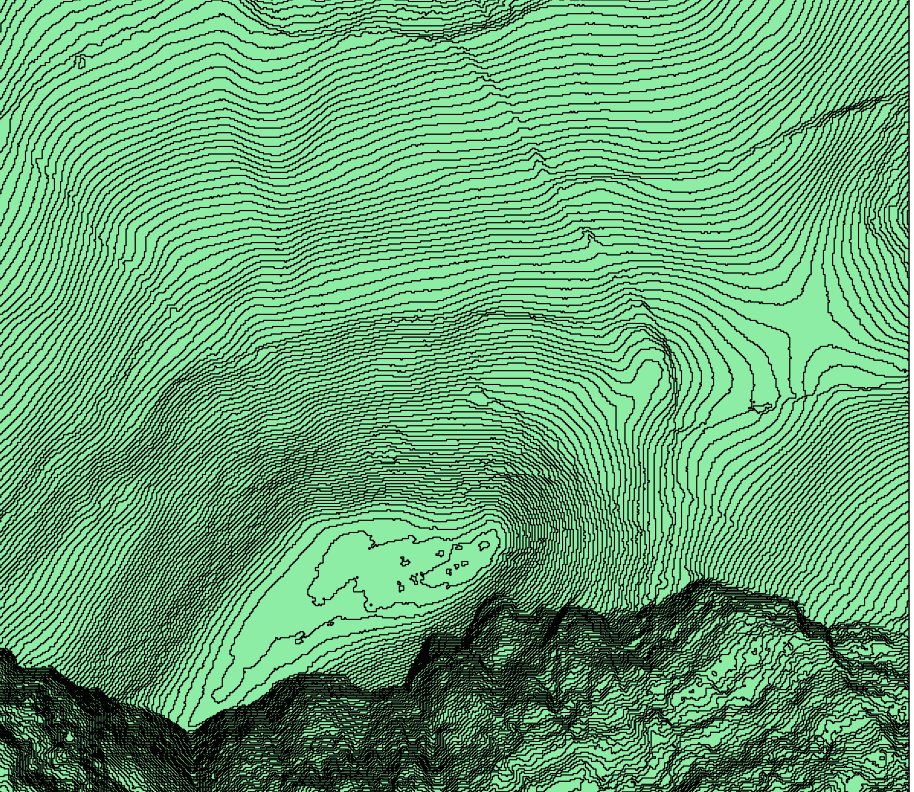
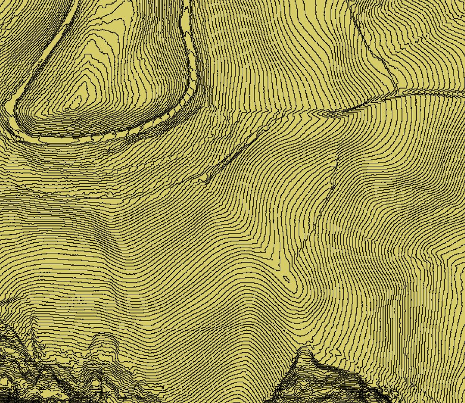
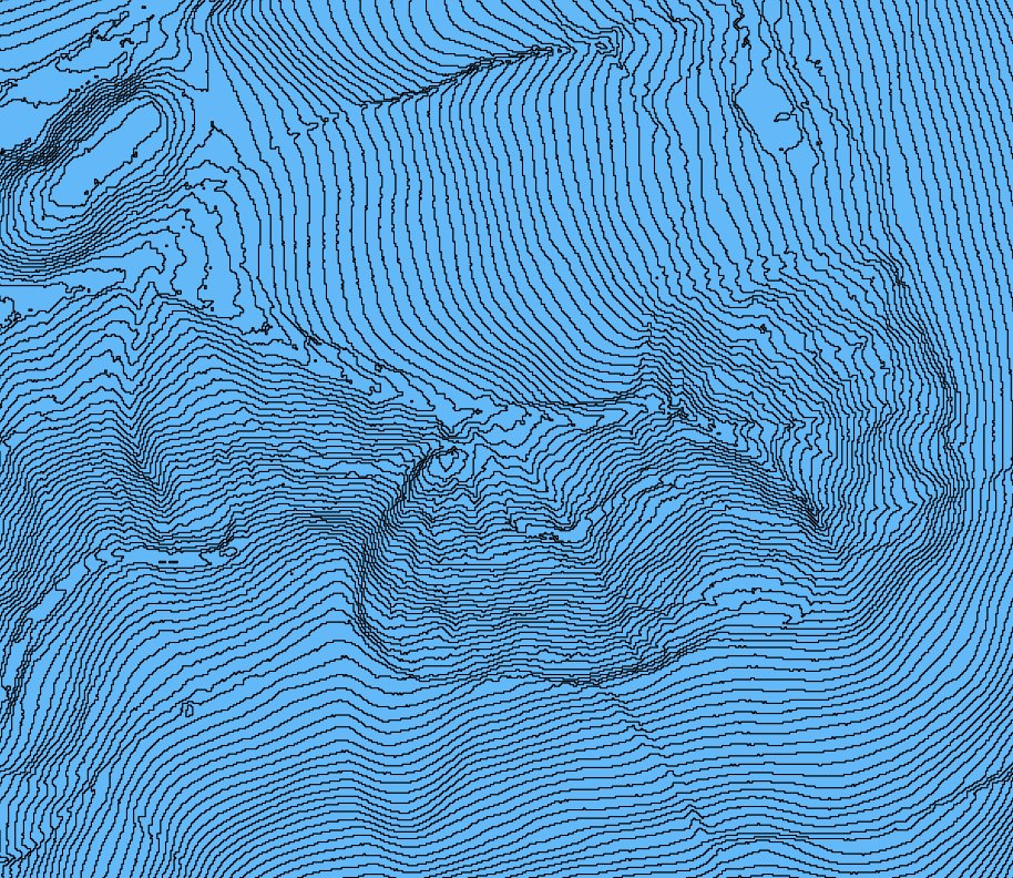
The LiDAR template was invaluable for map drawing. I also wondered how standalone images would look without hill-shading, so I produced the jpegs below by extracting binary data from LiDAR with QGIS software (open source), converting vector imagery into contour lines, and processing the results in an image editor. The landforms are beautiful, almost tactile, as they derive from contours spaced at 1m intervals!
The first image is of Golden Cap itself, the highest point on the south coast at 191m above sea level. You can clearly discern the flat top of the hill overlooking the high cliffs immediately south of it.
The second image is the southern end of Langdon Hill with a steep slope south towards the cliffs. You can almost reach out and feel the valleys and spurs! Part of the level vehicle track circling round the hill is also clear and you can even make out some earthbank field boundaries.
The third image is of Filcombe and St Gabriel's woods - the area which originally motivated me to investigate LiDAR. There are no detailed OS maps of this dense and difficult woodland, and I was perplexed by struggling through marshy green terrain, finding unmapped stream valleys. Now, all is revealed.
If you've not yet resolved never, ever, to come anywhere near these contours, you'll be pleased to know the map is progressing well and we plan to try it out in 2014. It might be a good idea to keep 22 November free...
We look forward to welcoming you to wild West Dorset!!
Mike Kite
National Trust information Wikipedia Jurassic Coast page
Background: view SW to Golden Cap from Langdon Hill