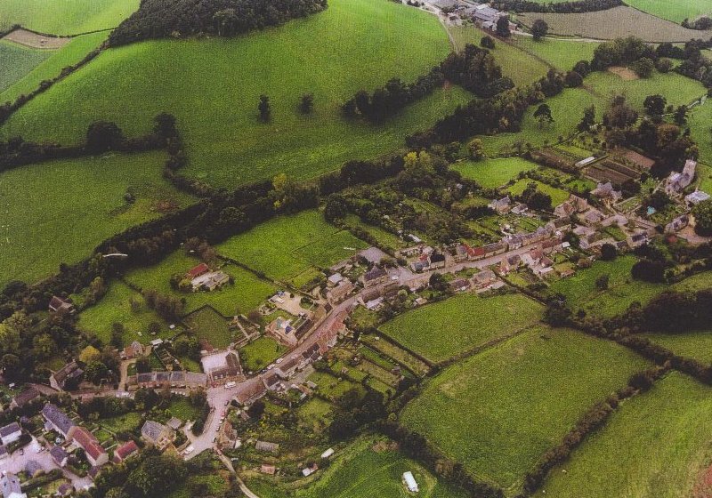
AERIAL VIEW OF LODERS VILLAGE FROM THE NORTH-EAST
The school is in the bottom left (eastern) quadrant of the photograph
AERIAL VIEW OF LODERS VILLAGE FROM THE NORTH-EAST
The school is in the bottom left (eastern) quadrant of the photograph
The east-west village road is visible as far as the church. The Loders Arms can be identified by the pub car park to the west (right) of it. Running parallel to and south of the road is the River Asker, its course being marked by a distinct line of trees.
Overlooking the village in the background is Boarsbarrow Hill. The profile of Boarsbarrow with the little copse on its summit is incorporated in the school badge.