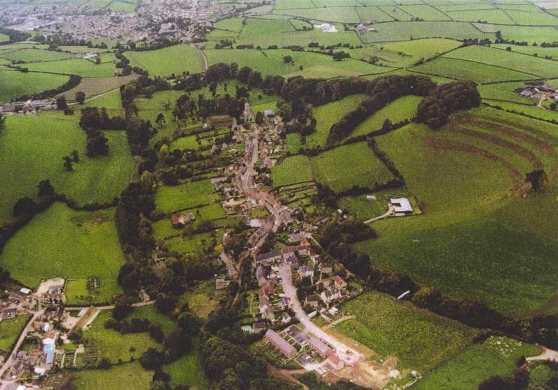
AERIAL VIEW OF LODERS VILLAGE FROM THE EAST
The school is in the centre of the photograph
AERIAL VIEW OF LODERS VILLAGE FROM THE EAST
The school is in the centre of the photograph
The village road bends north (right) by the church before continuing west towards Bridport. In the far south-west (top left) are the houses of Bradpole on the outskirts of Bridport.
To the north (right) are the strip-lynchets of Waddon Hill overlooking the village. Many new houses have been built in the near north-east (bottom right) since this photo was taken.
The course of the River Asker is marked by the line of trees south (left) of and parallel to the road. In the foreground the road bends south (left), crossing the river before resuming its easterly route along the valley. The course of the former Bridport-Maiden Newton railway can be distinguished as it curves north (right) away from the river.